Lecture 12 continents PDF
| Title | Lecture 12 continents |
|---|---|
| Course | The Planet Earth |
| Institution | University of California, Berkeley |
| Pages | 74 |
| File Size | 9.6 MB |
| File Type | |
| Total Downloads | 1 |
| Total Views | 116 |
Summary
Continents...
Description
Tectonics and the Evolution of the Continents
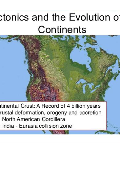
• Continental Crust: A Record of 4 billion years of crustal deformation, orogeny and accretion • The North American Cordillera • The India - Eurasia collision zone
Plate Tectonics Construction, Motion, Interaction and Destruction of Tectonic Plates
Plate Boundary Types • Divergent: Continental rifts and mid ocean ridges (Plate Construction) • Convergent: Subduction zones and continental collision zones (Destruction) • Transform: Strike-slip fault systems (Conservation)
California rocks Time Before Present (Ma)
0 100
Geologic Period Type of Margin Tertiary
400
Cretaceous Jurassic Triassic Permian Carboniferous Devonian
500
Ordovician
200 300
Local Events
Californian
San Andreas Transform
Franciscan Subduction
Andean
Foothills Subduction Sonoma Orogeny Rift Events Antler Orogeny
Japanese
Cordilleran
Silurian
600 700
Cambrian
? Rift Events
Precambrian
Sequence
Miogeocline
Atlantic
???????
?
Global Events Circum-Pacific Subduction Atlantic-Indian Spreading
Hercynian orogeny Paleopacific Ocean
Panafrican orogenies of Gondwanaland
Early Paleozoic 570-350 Ma
570-350 Ma Atlantic type passive margin Sedimentary deposits at edge of continent
Early Paleozoic 570-350 Ma
Mid Paleozoic 400-350 Ma
Late Paleozoic 400-250 Ma
400-250 Ma Japanese type subduction and accretion of island arc
Early Paleozoic 570-350 Ma
Mid Paleozoic 400-350 Ma
Late Paleozoic 400-250 Ma
Early Mesozoic 250-150 Ma
Late Mesozoic 150-65 Ma
200-65 Ma Andean type subduction and volcanic arc + forarc basin
Early Paleozoic 570-350 Ma
65-20 Ma Volcanism ends, sediment deposition in forarc basin
Early Cenozoic 65-20 Ma
Early Paleozoic 570-350 Ma
20-00 Ma California type margin San Andreas Fault initiates Basin and Range extension
Late Cenozoic 20-0 Ma
Early Paleozoic 570-350 Ma
Mid Paleozoic 400-350 Ma
Late Paleozoic 400-250 Ma
Early Mesozoic 250-150 Ma
Late Mesozoic 150-65 Ma
Early Cenozoic 65-20 Ma
Late Cenozoic 20-0 Ma
Foredeep basin of arcrelated clastic sediments Accretionary Prism (scraped off subducted oceanic slab) Sierran magmatic Arc (plutonic/volcanic)
Forearc basin
Trench axis Trench slope break Blueschist metamorphism
Hydrothermal Mother Lode Gold Quartz Veins (140-110 Ma)
Franciscan Accretionary Wedge
Great Valley Sequence
Metamorphic Foothills Belt
Andean Type Strata Volcanos
Sierra Nevada Batholith
Subducting Oceanic lithosphere
Asthenosphere
Granitic Plutons
Overriding Gold in solution in Continental hot water Lithosphere in faults
California Gold Rush (1848-1855): 12 millions ounces removed in first 5 years
Subduction regimes cause thermal anomalies: Cold dense slab induces relatively cold temperatures at depth Midocean Ridge
Oceanic Plate
500 degree isotherm
High P and Low T: Q - What type of metamorphic Rock?
Subduction
Continent
Passive margin
Metamorphic rocks: Temperature (oC) à 0
200
400
600
800
Low P, high T
0
Hornfels
10 4
Greenschist
6
20 Blueschist
8 Amphibolite
Granulite
30
10
High P, low T 12
Eclogite
40
Depth (km) à
ß Pressure (kbars)
2
During subduction
After subduction ceased
Trailing edge of slab
Structure of Continents • Continents are made and deformed by plate motion (1/3 of Earth surface). • Continental crust thickness: 30–70 km • Continents are older than oceanic crust (Up to 4.0 Ga old). • Lithosphere floats (isostatically) on a viscous layer below. • Granitic-andesitic composition of crust less dense than oceanic crust
Structure of Continents
?
Cratons (Shields & Platforms) and Orogens
Tectonics From the Beginning
< 0.23 Ga 0.55–0.23 Ga 0.6 Ga
>2.5 Ga
• Ages of crustal domains reveal the growth of the continents • Some continental crust beneath the oceans
2009 GEOLOGIC TIME SCALE
C5A
C5B
5E 6
C5E
M
13.8 16.0
20.4 23.0
30
11
C9 C10 C11
12 C12
35
13
C13
15 16
C15
17
OLIGOCENE
9 10
E
130
140
150
RUPELIAN 33.9
37.2
170
BARTONIAN
C21
22
C22
23
C23
EOCENE
21
PALEOGENE
C20
40.4
M
180
190
LUTETIAN
48.6
E
24
210
YPRESIAN
C26
60 27 28
65
C27 C28
29 C29
30 C30
PALEOCENE
C25
L M
55.8
220
58.7
230
THANETIAN SELANDIAN 61.7
E
240
DANIAN 65.5
250
PERMIAN
280
93.5 99.6
112
320
APTIAN EARLY
125
BARREMIAN
340
130
VALANGINIAN BERRIASIAN
136
360
145.5
TITHONIAN
HIST.
ANOM.
M22
151 LAT E
MIDDLE
380
KIMMERIDGIAN OXFORDIAN CALLOVIAN BATHONIAN BAJOCIAN AALENIAN
156 161 165
400
172
420
183
PLIENSBACHIAN
440 190
SINEMURIAN 197
HETTANGIAN 201.6
460
204
480 LAT E
NORIAN 500 228
CARNIAN 235 MIDDLE
LADINIAN
EARLY
OLENEKIAN
ANISIAN INDUAN
520
241 245 250
251.0
WORDIAN ROADIAN KUNGURIAN
AGE (Ma)
EON
ERA
PERIOD
540
260 266 268 271 276 284
ASSELIAN GZELIAN KASIMOVIAN MOSCOVIAN
BASHKIRIAN
297 299.0 304 306 312
EDIACARAN 630
850
TONIAN
1250
1500
345 359
1750
FAMENNIAN 374
1000
2000
M
EIFELIAN EMSIAN PRAGHIAN
L M E
PRIDOLIAN LUDFORDIAN GORST IAN HOMERIAN SHEINWOODIAN T ELYCHIAN AERONIAN RHUDDANIAN
HIRNANTIAN
L
KATIAN SANDBIAN
M
DARRIWILIAN DAPINGIAN
FLOIAN E Furongian Series 3 Series 2 Terreneuvian
TREMADOCIAN STAGE 10 STAGE 9 PAIBIAN GUZHANGIAN DRUMIAN STAGE 5 STAGE 4 STAGE 3
385
1200
MESOPROTEROZOIC
398 407 411 416 419 421 423 426 428 436 439 444 446
1400
1600
STATHERIAN 1800
OROSIRIAN
2250 2300
SIDERIAN 2500
488 492 496 501 503 507 510 517 521
2500
NEOARCHEAN 2750 2800
3000
468 472 479
535 542
2050
RHYACIAN
455 461
ECTASIAN
CALYMMIAN
392
3250
3500
MESOARCHEAN 3200
PALEOARCHEAN 3600
3750
EOARCHEAN
STAGE 2 FORTUNIAN
STENIAN
PALEOPROTEROZOIC
FRASNIAN GIVETIAN
CRYOGENIAN
1000
VISEAN TOURNAISIAN
NEOPROTEROZOIC
750
318 326
BDY. AGES (Ma) 542
251 254
SAKMARIAN
LOCKHOVIAN
TOARCIAN EARLY
CAPITANIAN
SERPUKHOVIAN MISSISSIPPIAN
E
168 176
PENNSYLVANIAN
L
140
CHANGHSINGIAN WUCHIAPINGIAN
ARTINSKIAN E
300
ALBIAN
200
C24
26
89.3
RHAETIAN
55 25
CONIACIAN
M
CENOMANIAN
M12 M14 M16 M18 M20
160
PRIABONIAN
SANT ONIAN
HAUTERIVIAN
M29
C17
45
M0r M1 M3 M5
M25
C18
20
120
28.4
L
C16
19 C19
50
CHATTIAN
L 260
83.5 85.8
T URONIAN
M10
L
18
40
110
AQUITANIAN
TERTIARY
25
34 C34
BURDIGALIAN E
C6B
C7 C7A C8
100
LANGHIAN
6C C6C 7 7A 8
CHRON.
11.6
SERRAVALLIAN
C6
6A C6A 6B
90
TORTONIAN
LAT E
PRECAMBRIAN PICKS (Ma)
PROTEROZOIC
C5
5C C5C 5D C5D
20
C33
80
7.2
L
70.6
CAMPANIAN
33
AGE
65.5
32 C32
C4 C4A
MAASTRICHTIAN
AGE PERIOD EPOCH (Ma)
CARBONIFEROUS
5B
30 C30 31 C31
PICKS (Ma)
DEVONIAN
15
5.3
MESSINIAN
70
AGE
ORDOVICIAN SILURIAN
5A
CALABRIAN
GELASIAN PIACENZIAN
ZANCLEAN
PERIOD EPOCH
CAMBRIAN*
5
PLIOCENE
MAGNET IC POLARIT Y
RAPID POLARITY CHANGES
4 4A
10
QUATERNARY PLEISTOCENE
0.01 1.8 2.6 3.6
AGE (Ma)
CRETACEOUS
C3 C3A
HOLOCENE
PALEOZOIC
MESOZOIC PICKS (Ma)
JURASSIC
3 3A
AGE
TRIASSIC
C2 C2A
EPOCH
MIOCENE
5
C1
2 2A
PERIOD
NEOGENE
HIST.
ANOM.
1
CHRON.
MAGNETIC POLARITY
ARCHEAN
CENOZOIC AGE (Ma)
3850
HADEAN
*International ages have not been fully established. These are current names as reported by the International Commission on Stratigraphy. Walker, J.D., and Geissman, J.W., compilers, 2009, Geologic Time Scale: Geological Society of America, doi: 10.1130/2009.CTS004R2C. ©2009 The Geological Society of America. Sources for nomenclature and ages are primarily from Gradstein, F., Ogg, J., Smith, A., et al., 2004, A Geologic Time Scale 2004: Cambridge University Press, 589 p. Modifications to the Triassic after: Furin, S., Preto, N., Rigo, M., Roghi, G., Gianolla, P., Crowley, J.L., and Bowring, S.A., 2006, High-precision U-Pb zircon age from the Triassic of Italy: Implications for the Triassic time scale and the Carnian origin of calcareous nannoplankton and dinosaurs: Geology, v. 34, p. 1009–1012, doi: 10.1130/G22967A.1; and Kent, D.V., and Olsen, P.E., 2008, Early Jurassic magnetostratigraphy and paleolatitudes from the Hartford continental rift basin (eastern North America): Testing for polarity bias and abrupt polar wander in association with the central Atlantic magmatic province: Journal of Geophysical Research, v. 113, B06105, doi: 10.1029/2007JB005407.
When did continents form? Quite a bit of debate . . .
Hawkesworth and Kemp, Nature (2006)
Shields (e.g., Canada)
Shields (e.g., Canada) Earth’s oldest rocks: The Acasta Gneiss from the Slave Province of NW Canada: ~4.0 Ga
Stable Platforms • Shields covered with series of horizontal sedimentary rocks • Transgressions and regressions caused by sea level changes and vertical tectonics • Sedimentary rocks are now preserved in large basins
Stable Platforms
Vertical Tectonics of Continent Interiors Isostacy
Lithospheric thinning and asthenosphere upwelling
Loading by sedimentary basins
Cooling and sedimentation of passive margins
Uplift by rising mantle plume
Uplift Formed by Removal of Ice Sheet
Continental ice loads the mantle Ice causes isostatic subsidence
Melting of ice causes isostatic uplift Return to isostatic equilibrium
Isostacy
Models of Isostacy
Uplift Caused by Rising Mantle Plume
Mountain Belts / Orogeny • Relatively narrow zones of folded, compressed rocks formed at convergent plate boundaries • Two major active belts: Cordilleran (Alaska to Andes), and AlpineHimalayan Belts • Older examples: Appalachians, Urals
Mountain Belts / Orogeny The Appalachian orogen includes accretion of • continental fragments, island arcs and • African crust throughout the Paleozoic 3 main phases from middle Ordovician through early Permian epochs
Mountain Belts / Orogeny The Appalachian orogen includes accretion of • continental fragments, island arcs and • African crust throughout the Paleozoic 3 main phases from middle Ordovician through early Permian epochs (The Taconic, CaledonianAcadian, Variscan and Appalachian Orogenies)
Cycles of Break-up and Orogenies • The Wilson cycle
The Make-up of N America • The interior shield and platform regions (craton) have only had vertical deformation since Precambrian (epeirogeny)
The North American Cordillera • The western third of North America the “Cordillera” underwent complex geologic history with multiple episodes of accretion, deformation and magmatism over the past 500 million years • The region is actively deforming today
The North American Cordillera • Physiography reveals – Sierra Nevada batholiths and Central Valley foreland basin – Cascadia active subduction zone – Rocky Mountains resulting from intra-plate orogeny – Hot Spot tectonics of Snake River plain & Yellowstone – Basin and Range extension of faltering high plateau – San Andreas transform faulting & Coast Ranges uplift – The Mendocino Triple Junction
The North American Cordillera • Rocky Mountains – Resulted from intra-plate Laramide orogeny. possibly from shallow subduction – Cenozoic (75-35 Ma) – Minor deformation today
The North American Cordillera • Hot Spot tectonics of Snake River Plain and Yellowstone • 20 Ma – active today • Which way is plate moving?
W or E?
The North American Cordillera • Hot Spot tectonics of Snake River Plain and Yellowstone • 20 Ma – active today • Which way is plate moving?
W or E? North America is moving to the west, relative to Yellowstone hot spot
The Yellowstone Caldera •
Active hot spot geothermal activity • Mega caldera eruptions • Rapid current vertical deformation (from GPS and InSAR)
http://www.mines.utah.edu/~rbsmith/RESEARCH/YellowstoneHotspot.html
The North American Cordillera • Hot Spot tectonics of Snake River Plain and Yellowstone • 20 Ma – active today • Which way is plate moving?
W or E? North America is moving to the west, relative to hot spot
The North American Cordillera • Basin and Range – Cenozoic extension of faltering high plateau – Steep E- and W-dipping normal faults (“grabens”) – Incipient continental rift? – Stable Colorado Plateau block to SE – Mid-Cenozoic – active today
Basin and Range Deformation • GPS-measured motions are relative to stable North American shield stations • Not much east of Utah • Only ~ 2mm/yr extension across Wasatch front, but earthquake hazard is significant • About 10 mm/yr of extension and right-lateral shear along Eastern California Shear Zone
Farallon Plate Subduction and SAF Transform Faulting
The North American Cordillera Sierra Nevada, California
The North American Cordillera • San Andreas Transform – Strike-slip faulting & tranpressional coast range uplift – From Mendocino triple junction to Baja California – Some motion now E of Sierra Nevada along eastern CA shear zone – Since ~28 Ma – active today – Coast range uplift since ~5 Ma
The North American Cordillera • Mendocino Triple Junction – Transition from San Andreas transform to Cascadia subduction – Moves northward as San Andreas grows – Creates slab window; mantle upwelling; volcanism and uplift
San Andreas Fault Deformation •
Motions are relative to stable North American shield stations • ~40 mm/yr between Sierras and Pacific in N Calif • ~48 mm/yr between NOAM and Pacific plate in S Calif • About 10 mm/yr along ECSZ
SCEC CMM 3.0
How Continents Grow • Magmatic addition and differentiation: magma transferred to continents at subduction zones • Continental accretion: buoyant fragments of continents attached to continents as the result of plate motions
How Continents Grow: Accretion o Terrane ” Multiple accretions of older island arcs, oceanic plateaus, oceanic crust, and marine sedimentary rocks.
How Continents Grow: Accretion o Terrane ”
How Continents Grow: Accretion o Terrane ”
India - Eurasia Collision Zone • From subduction to collision ...
The India-Eurasia Collision Zone •
The India - Eurasia collision zone spans 1000s km of distributed deformation • Collision started in Eocene, but India relentlessly presses on .. • Today, the Himalaya rise to > 8000 m elevations, the Tibetan plateau averages > 4500 m
Eurasia Mongolia Tibet S China India
Numbers are time (in Ma), showing relative position of India
India - Eurasia Collision Zone • From subduction to collision ...
The India-Eurasia Collision Zone • Collision began ~50 Ma; ~2000 km of motion since then • India is still rapidly (~45 mm/yr) converging with Eurasia • Where and how is this convergence accommodated?
Eurasia Mongolia Tien Shan Tibetan Plateau S China
Active Continental Collision or Escape Tectonics •
•
The Tibetan plateau is high, and crustal thickness is about twice (~70 km) of normal
Eurasia Mongolia
Strike-slip faulting & extension allow E extrusion of Tibet
Similar Free PDFs

Lecture 12 continents
- 74 Pages
12 - Lecture notes 12
- 3 Pages
Lecture notes, lecture 12
- 9 Pages

Lecture notes, lecture 12
- 7 Pages

Lecture 12
- 7 Pages

Lecture 12
- 3 Pages
Chapter 12 - Lecture notes 12
- 4 Pages

Lab 12 - Lecture notes 12
- 5 Pages
LEC 12 - Lecture notes 12
- 3 Pages

(12) Mistake - Lecture notes 12
- 8 Pages

Chapter 12 - Lecture notes 12
- 9 Pages
Popular Institutions
- Tinajero National High School - Annex
- Politeknik Caltex Riau
- Yokohama City University
- SGT University
- University of Al-Qadisiyah
- Divine Word College of Vigan
- Techniek College Rotterdam
- Universidade de Santiago
- Universiti Teknologi MARA Cawangan Johor Kampus Pasir Gudang
- Poltekkes Kemenkes Yogyakarta
- Baguio City National High School
- Colegio san marcos
- preparatoria uno
- Centro de Bachillerato Tecnológico Industrial y de Servicios No. 107
- Dalian Maritime University
- Quang Trung Secondary School
- Colegio Tecnológico en Informática
- Corporación Regional de Educación Superior
- Grupo CEDVA
- Dar Al Uloom University
- Centro de Estudios Preuniversitarios de la Universidad Nacional de Ingeniería
- 上智大学
- Aakash International School, Nuna Majara
- San Felipe Neri Catholic School
- Kang Chiao International School - New Taipei City
- Misamis Occidental National High School
- Institución Educativa Escuela Normal Juan Ladrilleros
- Kolehiyo ng Pantukan
- Batanes State College
- Instituto Continental
- Sekolah Menengah Kejuruan Kesehatan Kaltara (Tarakan)
- Colegio de La Inmaculada Concepcion - Cebu


