Surveying Field (Laboratory) - Laboratory Report 2 DPD Method, DMD Method, Bearings PDF
| Title | Surveying Field (Laboratory) - Laboratory Report 2 DPD Method, DMD Method, Bearings |
|---|---|
| Course | civil engineering |
| Institution | Pamantasan ng Lungsod ng Maynila |
| Pages | 7 |
| File Size | 549.8 KB |
| File Type | |
| Total Downloads | 76 |
| Total Views | 159 |
Summary
In this Laboratory report, you will learn how to use different methods on measuring an area with irregular shapes of lots. Furthermore, the example problems will help you master different problems involving DPD and DMD method....
Description
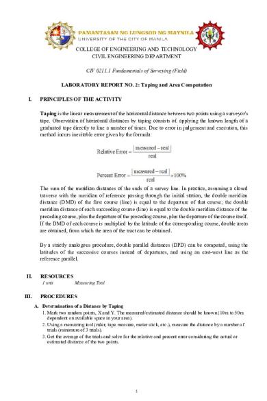
COLLEGE OF ENGINEERING AND TECHNOLOGY CIVIL ENGINEERING DEPARTMENT CIV 0211.1 Fundamentals of Surveying (Field) LABORATORY REPORT NO. 2: Taping and Area Computation I.
PRINCIPLES OF THE ACTIVITY Taping is the linear measurement of the horizontal distance between two points using a surveyor's tape. Observation of horizontal distances by taping consists of. applying the known length of a graduated tape directly to line a number of times. Due to error in judgement and execution, this method incurs inevitable error given by the formula:
The sum of the meridian distances of the ends of a survey line. In practice, assuming a closed traverse with the meridian of reference passing through the initial station, the double meridian distance (DMD) of the first course (line) is equal to the departure of that course; the double meridian distance of each succeeding course (line) is equal to the double meridian distance of the preceding course, plus the departure of the preceding course, plus the departure of the course itself. If the DMD of each course is multiplied by the latitude of the corresponding course, double areas are obtained, from which the area of the tract can be obtained. By a strictly analogous procedure, double parallel distances (DPD) can be computed, using the latitudes of the successive courses instead of departures, and using an east-west line as the reference parallel. II.
RESOURCES 1 unit
III.
Measuring Tool
PROCEDURES A. Determination of a Distance by Taping 1. Mark two random points, X and Y. The measured/estimated distance should be known (10m to 50m dependent on available space in your area). 2. Using a measuring tool (ruler, tape measure, meter stick, etc.), measure the distance by a number of trials (minimum of 3 trials). 3. Get the average of the trials and solve for the relative and percent error considering the actual or estimated distance of the two points.
1
B. Determination of an Area of a Closed Traverse by DPD Method. 1. Solve for the area of the given traverse using Double Meridian Distance Method.
2. Consider necessary adjustments to close the traverse. C. Determination of an Area of a Closed Traverse by DPD Method. 1. Solve for the area of the given traverse using Double Parallel Distance Method. Given lengths in meters.
2. Consider necessary adjustments to close the traverse.
IV.
DATA & RESULTS Table 1.1. Results of Taping a Distance TRIAL 1 2 3 4 5
LINE XY YX XY YX XY
MEASURED DISTANCE 16.28 16.3 16.50 16.40 16.12 2
NO. OF PACES 24 23 23 25 24
Table 1.2. Tabulation of Data for DMD Method
AB
LENGTH (m) 172.917m
BC
247.108m
S 49°38’ E
-160.04610
+188.27535
0.000477
0.002706
CD
281.240m
S 43°26’ W
-204.22940
-193.35534
0.000609
0.002779
DE
125.486m
N 39°22’W
+97.01357
-79.59337
0.000289
0.001144
EA
179.262m
N 18°53’W
+169.61404
-58.01674
0.000506
0.000834
SUM
1006.013
+0.003
+0.01446
+0.002173
+0.009515
LINE
LINE
CORR LATITUDE
CORR DEPARTURE
BEARING
LATITUDE
DEPARTURE
N 55°37’ E
+97.65089
+142.70456
0.000291
0.002051
LENGTH (m)
ADJUSTED LATITUDE
ADJUSTED DEPARTURE
DMD
DOUBLE AREA
AB
172.917m
97.6505988
142.7025
142.7025088
13934.98544
BC
247.108m
-160.0465773
188.2726
473.6776615
-75810.48845
CD
281.240m
-204.230009
-193.358
468.5921861
-95700.58639
DE
125.486m
97.0132807
-79.5945
195.6395528
18979.63485
EA
179.262m
169.6135342
-58.0176
58.02746487
9842.243397
0.000827402 ≃0
0.004945481≃ 0
SUM
AREA
128754.2111
211221.28 𝒇𝒕𝟐
Table 1.3. Tabulation of Data for DPD Method LINE
LENGTH (m)
BEARING
LATITUDE
DEPARTURE
CORR LATITUDE
CORR DEPARTURE
AB
285.10
S 26°10’W
-255.882
-125.724
0.0813
-0.0616
BC
610.45
N 75° 25’W
153.704
-590.783
0.174
-0.1319
CD
720.48
N 15°30’ E
694.276
192.54
0.2054
-0.1557
DE
203.00
S 1°42’ E
-202.911
6.022
0.0579
-0.0439
EA
647.02
S 53°6’ E
-388.484
517.412
0.1844
-0.1398
SUM
2466.05
0.703
-0.533
0.703
-0.533
LINE
LENGTH (m)
ADJUSTED LATITUDE
ADJUSTED DEPARTURE
DOUBLE AREA
AB
285.10
-255.9633
-125.6624
-255.9633
32164.96259
BC
610.45
153.53
-590.6511
-358.3966
211687.346
CD
720.48
694.0706
192.6957
489.204
94267.50722
DE
203.00
-202.9689
6.0659
980.3057
5946.436346
EA
647.02
-388.6684
517.5518
388.6684
201156.03
SUM
2466.05
0
0.0001 ≃ 0
AREA
V.
DPD
272611.141𝑚2
CALCULATIONS
3
545222.2822
A. Determination of a Distance by Taping
Exact Distance of line XY = 16.30 m Average of Trials: 𝐴𝑉𝐺 =
16.28 + 16.3 + 16 .50 + 16.40 + 16.12 = 𝟏𝟔. 𝟑𝟎𝟒𝒎 5
Relative Error: 𝑅𝑒𝑟𝑟𝑜𝑟 =
|16.304 − 16.30| = 𝟎. 𝟎𝟎𝟎𝟐𝟒𝟓 16.30
Percent Error: |16.304 − 16.30| ∗ 100% = 𝟎. 𝟎𝟐𝟓% 16.30
𝑃𝑒𝑟𝑟𝑜𝑟 =
B. Determination of an Area of a Closed Traverse by DMD Method.
[Convert ft – m] 𝑨𝑩 = 𝟓𝟔𝟕. 𝟑𝟒 𝒇𝒕 𝒙 𝑩𝑪 = 𝟖𝟏𝟎. 𝟕𝟔 𝑓𝑡 𝒙 𝑪𝑫 = 𝟗𝟐𝟐. 𝟕𝟓 𝑓𝑡 𝒙 𝑫𝑬 = 𝟒𝟏𝟏. 𝟕𝟐 𝑓𝑡 𝒙 𝑬𝑨 = 𝟓𝟖𝟖. 𝟏𝟔 𝑓𝑡 𝒙
[Computation of Lat and Dep] Using calculator features (Rec)
𝟏𝒎 = 𝟏𝟕𝟐. 𝟗𝟏𝟕𝒎 𝟑. 𝟐𝟖𝟏 𝒇𝒕 𝟏𝒎 = 𝟐𝟒𝟕. 𝟏𝟎𝟖𝒎 𝟑. 𝟐𝟖𝟏 𝒇𝒕 𝟏𝒎 = 𝟐𝟖𝟏. 𝟐𝟒𝟎𝒎 𝟑. 𝟐𝟖𝟏 𝒇𝒕 𝟏𝒎 = 𝟏𝟐𝟓. 𝟒𝟖𝟔𝒎 𝟑. 𝟐𝟖𝟏 𝒇𝒕 𝟏𝒎 = 𝟏𝟕𝟗. 𝟐𝟔𝟐𝒎 𝟑. 𝟐𝟖𝟏 𝒇𝒕
LATITUDE AB = Rec(172.917, 55°37’) -
+97.65089
+142.70456
BC = Rec(247.108, 49°38’) -
-160.04610
+188.27535
CD = Rec(281.240, 43°26’) -
-204.22940
-193.35534
+97.01357
-79.59337
DE = Rec(125.486,39°22’) EA = Rec(179.262 ,
[Correction for Latitude]
𝑨𝑩 = 0.003 𝒙 𝑩𝑪 = 0.003 𝒙
𝑪𝑫 = 0.003 𝒙 𝑫𝑬 = 0.003 𝒙 𝑬𝑨 = 0.003 𝒙
𝟏𝟎𝟎𝟔.𝟎𝟏𝟑 −160.04610
𝟏𝟎𝟎𝟔. 𝟎𝟏𝟑 +97.01357
𝟏𝟎𝟎𝟔. 𝟎𝟏𝟑 +169.61404
𝟏𝟎𝟎𝟔. 𝟎𝟏𝟑
18°53’)
+169.61404
-
-58.01674
[Correction for Departure]
+97.65089
𝟏𝟎𝟎𝟔. 𝟎𝟏𝟑 −204.22940
DEPARTURE
= 0.000291
𝑨𝑩 =
= 0.000477
0.01446 𝒙
𝑩𝑪 = 0.01446 𝒙
= 0.000609
𝑪𝑫 = 0.01446 𝒙
= 0.000289
𝑫𝑬 = 0.01446 𝒙
= 0.000506
𝑬𝑨 = 0.01446 𝒙
[Adjusted Latitude]
142.70456
𝟏𝟎𝟎𝟔.𝟎𝟏𝟑 188.27535
𝟏𝟎𝟎𝟔. 𝟎𝟏𝟑 193.35534
𝟏𝟎𝟎𝟔. 𝟎𝟏𝟑 79.59337
𝟏𝟎𝟎𝟔. 𝟎𝟏𝟑 58.01674
𝟏𝟎𝟎𝟔. 𝟎𝟏𝟑
= 0.002051 = 0.002706 = 0.002779 = 0.001144 = 0.000834
[Adjusted Departure]
AB = +97.65089 - 0.000291 = 97.6505988
AB = 142.70456 - 0.002051 = 142.7025088
BC = -160.04610 - 0.000477 = -160.0465773
BC = 188.27535 - 0.002706 = 188.2726438
CD = -204.2294- 0.000609 = -204.230009
CD = -193.35534 - 0.002779 = -193.3581192
DE = 97.01357- 0.000289 = 97.0132807
DE = -79.59337 - 0.001144 = -79.59451404
EA = 169.61404 - 0.000506 = 169.6135342
EA = -58.01674 - 0.000834 = -58.01757391 4...
Similar Free PDFs
Surveying Field Report
- 6 Pages

Lab 1 - Laboratory Report
- 10 Pages

Laboratory+report+1-4
- 11 Pages

Laboratory 11 - Lab Report
- 3 Pages

Laboratory report - aspirin
- 8 Pages

Laboratory Report 1 SKO3023
- 30 Pages

Laboratory Report Rubric
- 2 Pages
Laboratory Techniques Lab Report
- 4 Pages

LABORATORY REPORT EXPERIMENT 5
- 6 Pages

Laboratory report for BIO
- 4 Pages
Reynold\'s Number Laboratory Report
- 11 Pages
NMR Laboratory Report
- 17 Pages
Popular Institutions
- Tinajero National High School - Annex
- Politeknik Caltex Riau
- Yokohama City University
- SGT University
- University of Al-Qadisiyah
- Divine Word College of Vigan
- Techniek College Rotterdam
- Universidade de Santiago
- Universiti Teknologi MARA Cawangan Johor Kampus Pasir Gudang
- Poltekkes Kemenkes Yogyakarta
- Baguio City National High School
- Colegio san marcos
- preparatoria uno
- Centro de Bachillerato Tecnológico Industrial y de Servicios No. 107
- Dalian Maritime University
- Quang Trung Secondary School
- Colegio Tecnológico en Informática
- Corporación Regional de Educación Superior
- Grupo CEDVA
- Dar Al Uloom University
- Centro de Estudios Preuniversitarios de la Universidad Nacional de Ingeniería
- 上智大学
- Aakash International School, Nuna Majara
- San Felipe Neri Catholic School
- Kang Chiao International School - New Taipei City
- Misamis Occidental National High School
- Institución Educativa Escuela Normal Juan Ladrilleros
- Kolehiyo ng Pantukan
- Batanes State College
- Instituto Continental
- Sekolah Menengah Kejuruan Kesehatan Kaltara (Tarakan)
- Colegio de La Inmaculada Concepcion - Cebu


